
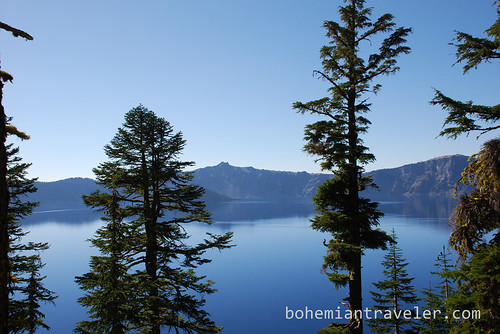
Almost 7,000 years ago, the 12,000-foot-high Mt. Mazama blew its top, caved in on itself, and eventually formed the United States’ deepest lake. Today it is known as Crater Lake, although technically it lies in a caldera. Crater Lake is the crown jewel of the Northwest’s Cascade Range. Its depth of 1,943 ft. (592 meters) absorbs all colors of the spectrum, except for blue and violet, which are reflected back to the sky, giving the spectacular blue appearance of the lake.
The Crater Lake National Park was established in 1902 to protect the unique geology of the lake and its surroundings. Unlike many National Parks in the US, development is minimal at Crater Lake, leaving plenty of uncontaminated views. Numerous hiking trails are accessible from the park’s Rim Drive. I hiked to the top of Mt. Scott, for magnificent views of the lake. There are also boat trips to the cinder cone Wizard Island and cross-country skiing and snow shoeing opportunities in winter.
Visiting Crater Lake was one of the main destinations of my 11,000-plus mile cross-country road trip in 2010.
If you go:
Crater Lake National Park is located about 5 ½ hours south of Portland and 7 ½ hours north of San Francisco. The 33-mile Rim Drive is usually closed mid-October through July due to the massive snow accumulation. The Visitor’s Center, located on the south side of the lake is open year round, 8:30am-4:30pm. The park has 210 campsites and a lodge. Admission is $10 per vehicle.
Text and Photos by Stephen Bugno
Submit your photo of the week to be featured at GoMad Nomad with a link back to your blog! Send a photo with a paragraph or two describing the photo or your experience to gomadnomadtravelmag [@] gmail.com
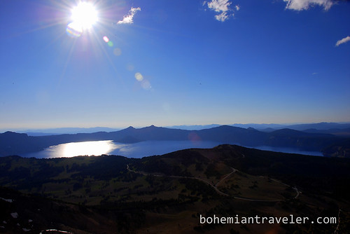
View of Crater Lake from the top of Mt Scott.
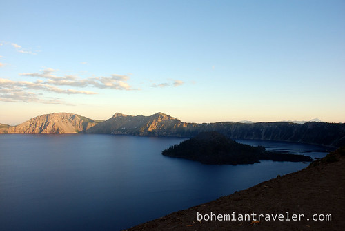
The cinder cone, Wizard Island.
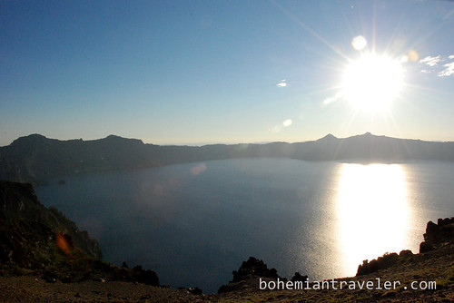
Crater lake in the gleaming sun.
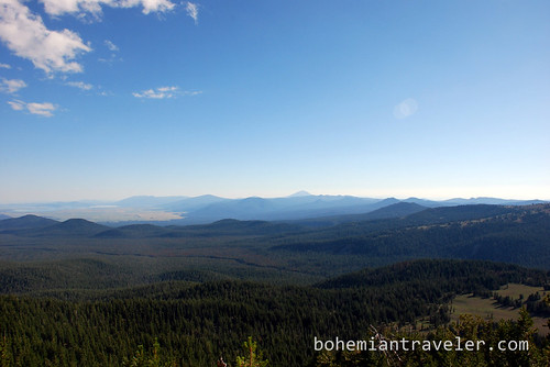
View of the forests and mountains surrounding Crater Lake.
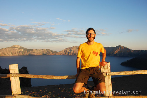
On the north side of Crater Lake.
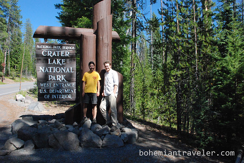
Welcome to Crater Lake sign.


beautiful pics. Oregon is still on my list to visit – I’ll have to go to Crater Lake
Most folks are uprised to learn that there is a lot more to do at Crater Lake than view the lake. For a range of options check out our Crater Lake National Park series at:
http://tinyurl.com/7edg4nj
Wow. Those photos are incredible. Make me want to grab my backpack and head out.
Fantastic photos. If you like hunting out places like this Google Earth lets you see altitudes of mountains, and what most people don’t realise is you can also see depths of lakes in it. Some of them, like Crater Lake are awe inspiring. (btw you can also sample the depths of the oceans and find where the very deep trenches are too…)